
How Does Google Maps Work? – The Tech Behind Series
Jerry Wallis
19 min read
Before jumping into the tech behind Google Maps, let’s take a quick trip down memory lane. Travelling is easier than ever before, but can you imagine how difficult it must’ve been to navigate to a new location 20-30 years back without smartphones, GPS tracking, and, most notably, digital maps? Sure, we might take these for granted now. Still, it’s essential to appreciate how far technology has come to help make an arduous activity such as travelling much easier to plan, manage and execute.
Today, if you need to go somewhere, say, a grocery store or a restaurant in an unfamiliar area, you type it into Google. It will show you a list of possible routes (along with recommendations) in a matter of seconds. Technology like this was unimaginable a couple of decades ago!
Google’s digital mapping solution is the most popular web mapping technology in the world, with over a billion monthly users. Here’s an ever crazier stat, every day, over a billion kilometres, are travelled with Google Maps!
The technology behind Google Maps allows users to view maps online and get valuable travel information in a few clicks. Google uses a combination of satellite imagery, aerial photography, street maps, 360° panoramic views of streets, and GIS data to provide up-to-date, comprehensive digital maps for route planning and travel via foot, car, bicycle, air or public transit.
In addition, Google maps also offer a variety of other unique and helpful features, such as turn-by-turn directions, street view, and public transportation schedules.
But that’s not the end of it! Google Maps is constantly updated with new features and data to optimise the application and improve its usefulness and usability. For example, Google recently added a new widget to show real-time traffic information near you even when the app is not running, or your screen is locked.
The multitude of valuable features, in conjunction with consistent updates and tweaks, big or small, are turning Google maps into a modern-day travelling pre-requisite for billions of people around the world.
And this brings us to the main agenda of this case study. Have you ever wondered what is driving this technological marvel? How does Google Maps provide you with all that information? What is driving the Google Maps system?
It’s no surprise that behind this seemingly simple application is a complex data collection process where information from various sources – previous app users, satellites, vehicles, and even camels- is collected to provide the navigational answers that users are looking for.
Over the last 17 years, the platform has evolved from an exclusively web-based application to the go-to navigational mobile app that provides updated and highly accurate real-time information against locational and directional queries.
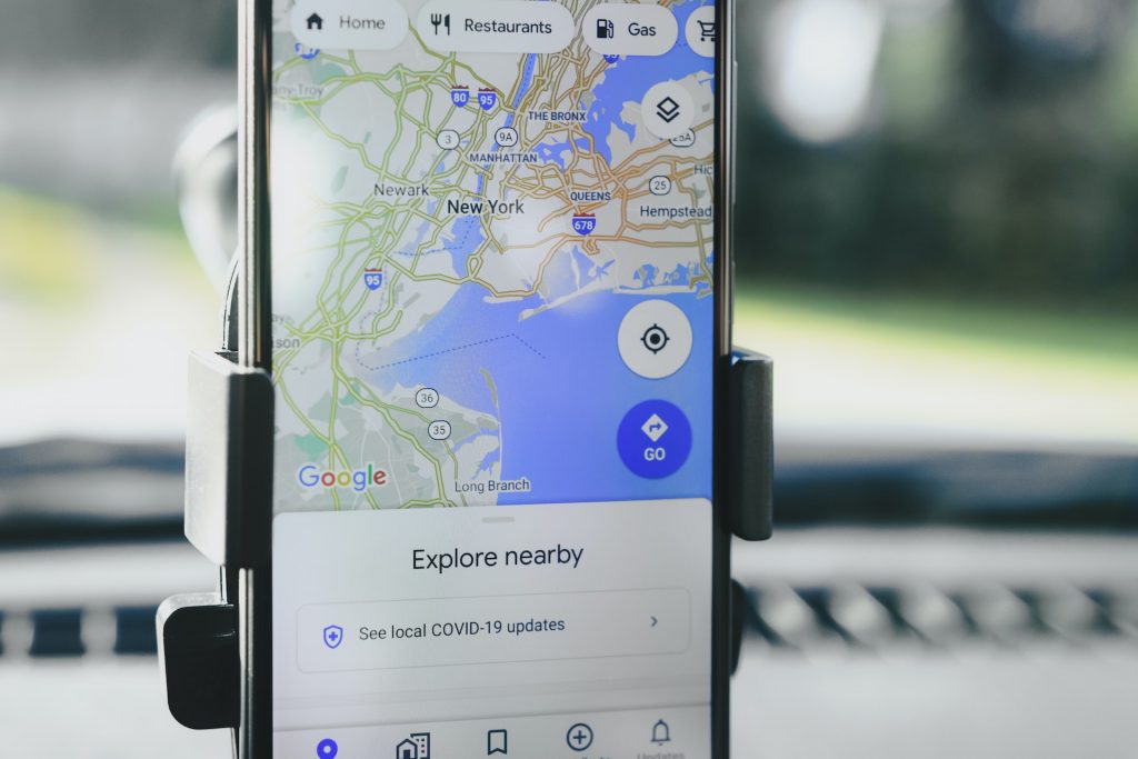
Think about it, with the Google Maps application, you can search for a place, like an address, an intersection, a restaurant, a cinema theatre or almost anything in the world. But, the question and topic we are interested in answering are how Google Maps provide you with this information. How does Google know all the routes, traffic conditions, transportation systems, and everything needed to provide you with the most accurate directions?
This article will explain the science involved in Google’s quest to remap the world. We’ll dive deep to uncover how Google had to revolutionise the technology we’re used to seeing. This is the tech behind Google Maps.
Firstly, How Does Google Maps Get It Right? 🤩😮
Not so long ago, looking up a location on a map meant unfolding a giant piece of paper and spending countless hours scanning through little dots, lines, and texts. Thankfully, those days are behind us! Fast forward a few decades, and now with Google Maps, you can zoom in so far on any part of the world on a digital map that you rarely encounter any problems travelling around. You literally have the most interactive map of the entire world in the palm of your hand.
Did you know? Over 150 million people worldwide are contributing information to Google Maps, with 50 million daily updates coming from the community and the public sector.
You can think of Google Maps as being alive, constantly feeding off information and updating and optimising the system to provide users with better recommendations and more current information. That said, the amount of data it collects has also attracted criticism from privacy experts.
More on all of this will be discussed further in the sections below. So, read on!
How Google Maps Came To Be – The Key Additions 📜
Before we move any further into the tech behind Google Maps, let’s quickly learn about the story of Google Maps and how it became the digital mapping juggernaut we know and love.
You might be surprised to know that Google wasn’t the first on the scene or even the second when it comes to digital mapping. But when Maps was launched in the mid-2000s, it had technology many people had never seen before. In addition, Google Maps was launched with satellite imagery in the browser, a technology system much ahead of its time.
Through Maps, people could now see their houses, their neighbourhood, and all of their familiar places on their computer screens, something that was unprecedented at that time.
No one had seen their own house in satellite imagery, much less in colour satellite imagery. This was a completely new and exciting view of the world. The cool part is that little did they know; this was just the beginning!
From there, Google started revamping and upgrading its digital mapping product through some shrewd buyouts. Much of Maps’ eventual success is partly down to the early acquisitions of Where 2 Technologies and Keyhole. The technological additions brought forth by pairing these two companies with Google’s existing engine improved Map’s quality considerably, making the product more accessible and interactive for consumers.
After acquiring Keyhole, Google got the critical software (pun intended!) needed to have an easy, ready-to-use satellite image reviewer globally, where 2 Technologies provided them with a much better user interface than available anywhere else. Where 2 had the unique concept of letting people scroll around a digital map-like interface without having to refresh or load a new webpage. This novel idea helped Google Maps gain a unique advantage over competing solutions.
After additional acquisitions of a geospatial data visualisation company and a realtime traffic analyser, Google Maps was launched in February 2005.
Photo Courtesy: CNET
The service’s front end utilises JavaScript, XML, and Ajax. Now, Google Maps offers an API that allows maps to be added to third-party websites and provides a locator for urban businesses and other organisations in numerous countries worldwide. Google also introduced the Google Map Maker in 2008 to allow users to collaboratively expand and update the service’s mapping worldwide.
Ultimately, combining the complementary technologies of their smart purchases with the sheer amount of capital Google could spend in ways to develop their application further that wasn’t deemed possible.
The Transformation of Google Maps 📈
Google Maps expanded its tech stack fairly quickly, opening it up to developers, integrating street view and launching Android and iOS apps early on.
But how exactly did all of this come together to get you from point A to point B? Christopher Phillips, the current head of Google’s Geo division, spoke with the Wall Street Journal earlier this year to provide an inside look behind the Google Maps technology.
Phillips said, “The foundational piece was to have a real-world model, the digital truth of what’s happening in the real world, including where streets are.”
To understand more about all these means, let’s look at an actual route in San Francisco that Chris talked through in the interview.
Phillips continued, “Let’s say I’m in the San Francisco fairy building, the farmer’s market, and I need to get to San Francisco International Airport.”
To get that real-world model Chris was talking about, Google starts with satellite and aerial imagery to create an accurate map. This is layered together with data from street view. To do this, they use a process called “photogrammetry”. Using the photogrammetry process with GPS data, Google can now pinpoint the correct coordinates for the image.
An analogy that you can use to understand this layer technology is to think of it as a giant jigsaw puzzle where you can combine these images. This way, Google understands the distance between images and where they sit with the actual location, i.e. the GPS location.
Google’s All-encompassing Image Capturing Process 📷
Google keeps a range of cameras used over time to capture imagery at the Street View garage on its campus in California. It all started with a 500-pound camera that was forklifted onto a van. You may have seen a Street View car with a 360-degree camera on top. The following section will cover Google Street View in more detail.
Some versions of the cameras are also equipped with LIDAR sensors which measure the distance from the camera to objects around it. Google’s camera technology also comes equipped with a GPS to get an accurate location of the camera’s position. Furthermore, they’ve adapted cameras to fit the terrain to reach more remote and conventionally inaccessible places.
Google has also been relatively creative with the camera placement, putting it on backpacks, for example, to get to places that cars can’t go. They’ve also used transportation like bikes and snowmobiles, and in some rarer cases, Google has gotten images from camels, divers and even astronauts. So it’s safe to say that they’ve left no stone unturned in an attempt to cover every patch of land on Earth.
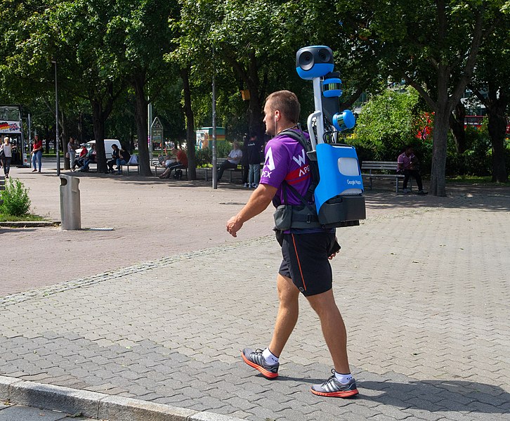
Photo Courtesy: Maksym Kozlenko | Creative Commons Attribution-Share Alike 4.0 International license
Recently, Google has come out with a new camera system that looks interesting and offers additional portability and ease of use. Their latest camera offers extra portability as they can be detached from cars to be carried around. In addition, these new cameras weigh around 15-pounds, are very lightweight and can be powered off of a phone as opposed to previous versions, which used to be a large computing units that fitted into the car. This new iteration of the Street View camera is currently being tested near the headquarters in Mountain View and will be widely used from next year onwards.
The new camera also has an affectionate and adorable personality, as seen in the image below.

Image Courtesy: CNN Business
The innovative thing to note, though, is that the imagery that Google captures isn’t just for looking at. Instead, it serves an ulterior purpose by helping keep their maps up to date by detecting changes since the last time images were taken.
The cameras are not just capturing what a place or an address looks like but also detecting changes over time, such as if a business might have moved, or a new building might have been built, or new signs such as a stop sign here or a traffic light there, all to ensure the information is as relevant and up-to-date as possible.
So, ultimately, understanding the new physical attributes of the natural world is what has enabled Google to derive its mapping application to be as current as possible.
Once they have all the information and imagery they need to figure out what the map will look like, Google layers on info about traffic, route and businesses. To do this, they get data from local municipalities, public bus and train schedules, and enterprises.
Google still uses its software from 2013 to edit maps through a combination of machine learning and map operators to edit public data, like road networks, to match exactly what you see on the layered imagery.
Since 2013, Google says they’ve been able to automate most of this process.
So, How Does Google Maps Work? 👨💻
While the acquisition of Where 2 was a big step in the right direction for the eventual launch and ultimate success of Google Maps, they needed more than just a presentable and intuitive visual interface. Fortunately, Google is, first and foremost, a data company above anything else. This meant they were working directly and had close ties with national and governmental institutions, granting them access to valuable information such as knowing exactly where every road is and how far apart the lanes are spaced and allocated on freeways, for example.
Unfortunately, often the government isn’t or won’t be able to provide a complete picture of how an area of land is laid out, which meant Google needed an alternative to plug the gaps of inaccessibility and inaccurate information. This is where the Google Street View we touched upon briefly earlier comes into the picture.
Now, you might be thinking, isn’t Street View just a way for people to virtually explore their surroundings? As it turns out, Google also uses Street View to double-check, tweak, and optimise its mapping data and information to stay up-to-date. The Street View cars were introduced to take pictures of surrounding areas in different places worldwide to validate existing data and make changes or updates wherever necessary.
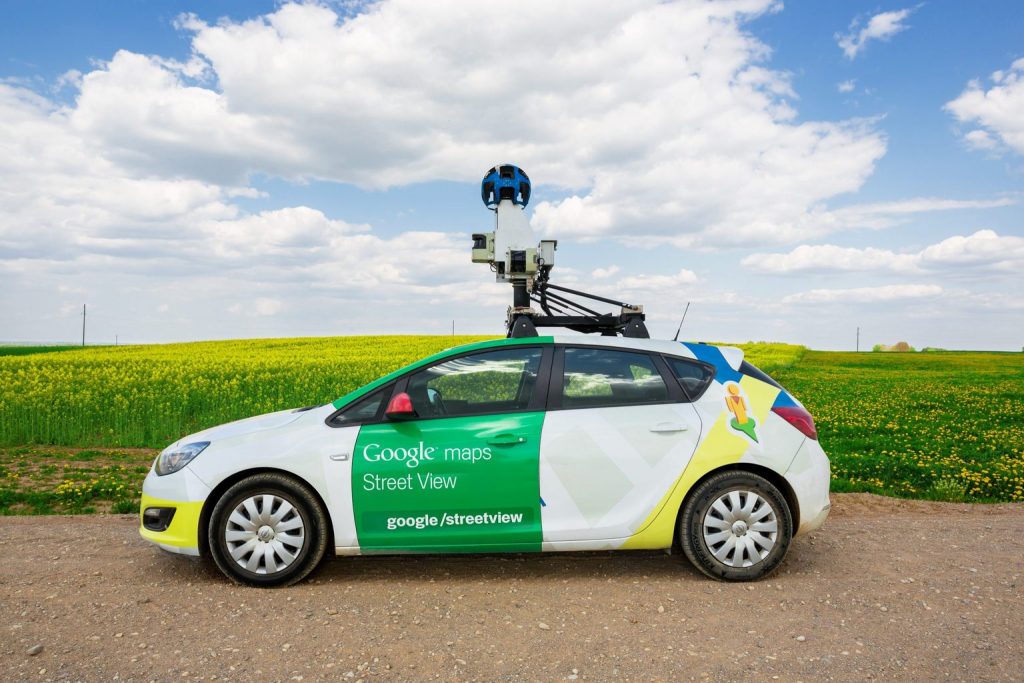
Image Courtesy: Michal Zduniak | Shutterstock
Within the Street View system, AI technology is used to recognise any signs caught by the cameras and send them to be analysed by Google servers to determine any inaccuracies, such as lane placement or traffic restrictions.
Furthermore, this technology also helps Google to validate things like brick-and-mortar addresses of local businesses. The information collected and validated is ultimately used to improve the application and prevent maps from giving any user inaccurate or potentially disruptive directions, such as sending someone the wrong way down a one-way street. Yikes! That would be a disaster.
Another critical tool in Google’s mapping data arsenal is its access to a massive amount of satellite imagery, mainly due to its acquisition of the satellite imagery service, Keyhole in 2004. Google also uses a top-down view of street markers to improve their mapping visualisations’ accuracy further. Add to that; they’ve now gotten to the point where they can use satellite imagery to extrapolate the shapes and footprints of buildings. Why is this cool? This technique allows Google to show 3D views of said buildings on Google Earth and will enable users to see outlines of these same buildings in the regular map view on Google Maps.
By combining data from multiple high-quality sources, Google Maps constructs quite an accurate picture of any particular area of the world, but even Google has its limitations.
For one, they still haven’t been able to automate the validation and adjustment process and still use human resources to make necessary adjustments to their existing mapping data based on user error feedback and reports received. This user-generated information is used to tweak routes on the map layer that don’t match up with recent satellite imagery or a Street View capture.
This gives us the perfect segue into another driving force in the Google Maps engine, crowdsourcing. Google relies partially on volunteers to map areas with limited data, such as less developed countries where it’s more challenging to send vehicles or receive accurate mapping data from governmental authorities.
Of course, this is not all that Google does to improve their user experience, as there was a time when they licensed databases from the yellow pages to dramatically enhance the number of businesses Maps would show. However, their business listings are currently pulled from other public sources. Only companies are eager and proactive enough to maximise the visibility that Google Maps offers are shown.
Interestingly enough, Google also partners with third-party services that keep track of gas (fuel & petrol, as we call it here in Australia😎) prices by looking at credit card data and getting direct data feeds from fuel station chains to bring you the most accurate fuel cost estimates of your planned travel route.
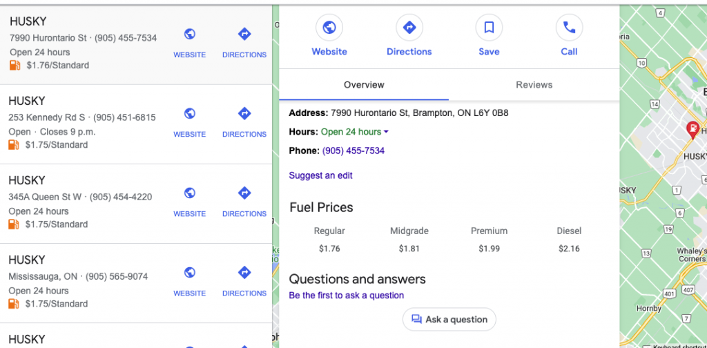
Lastly, if you haven’t thought about it already, you are a key player in making Google Maps as functional as it is. How? Whether or not you realise you’ve signed up for it is a story for another time. Still, Google also uses the location services and the GPS on your smartphone to understand (on top where you are and how to get you to a specific place) what times of day your favourite restaurant is the busiest!
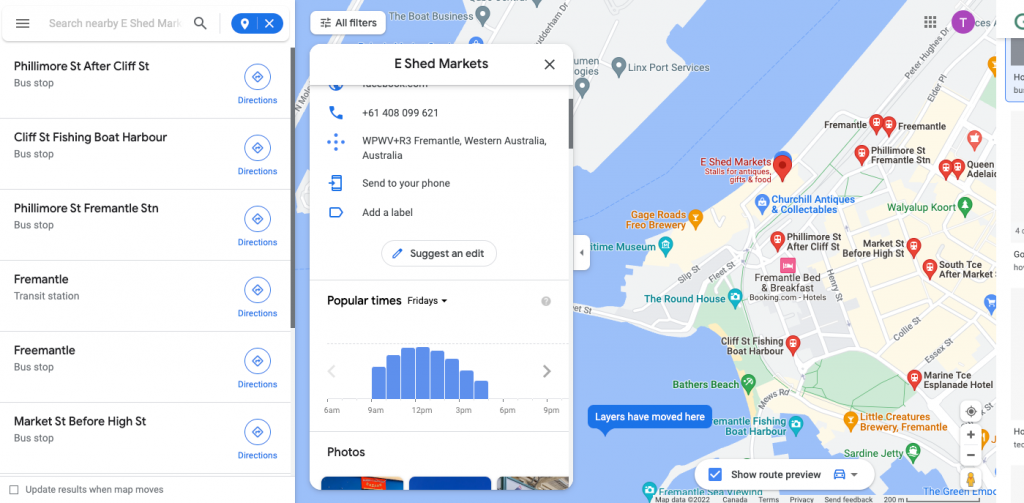
With the amount of data that Google has at their disposal, we wouldn’t be surprised if it also knew the exact demographic makeup of the clientele in each public location.
How Does Google Maps Know How Long It Takes To Get You From Point A To B? 📐
To predict how long it takes to get somewhere or how busy a place is, Google relies on reviews, contributed information and anonymised location data and uses complex algorithms to sieve through historical traffic patterns.
The Google Maps algorithm looks at current trends based on your unknown location, aggregated with millions of other users.
The idea is to overlay the trend with the current activity to create a prediction. The company also uses your approximate location and mapping tools to target ads and advertise businesses, which is one of the primary ways the platform is monetised.
So whether you’re searching for a place to go and if it’s relevant to those in that area, Maps can show advertised businesses as one of the results that may be of interest to your travel plans.
How Does Google Maps Know When There’s Traffic? 🚦
If you have a smartphone with Google Maps open and location services enabled, you’d be surprised that the app anonymously sends real-time data back to the Google servers.
This information is then used to estimate navigational questions such as:
- How many cars are on the road at a particular time of day?
- The speed at which these cars are moving
This points to the fact that the more people use the app, the more accurate the traffic data will be. In addition, to your smartphone, Google also uses traffic data from another app called Waze, which is a more concise version of Google Maps and specifically focuses on providing real-time traffic updates for cars on the road. Google acquired Waze back in 2013 for over a billion US dollars.
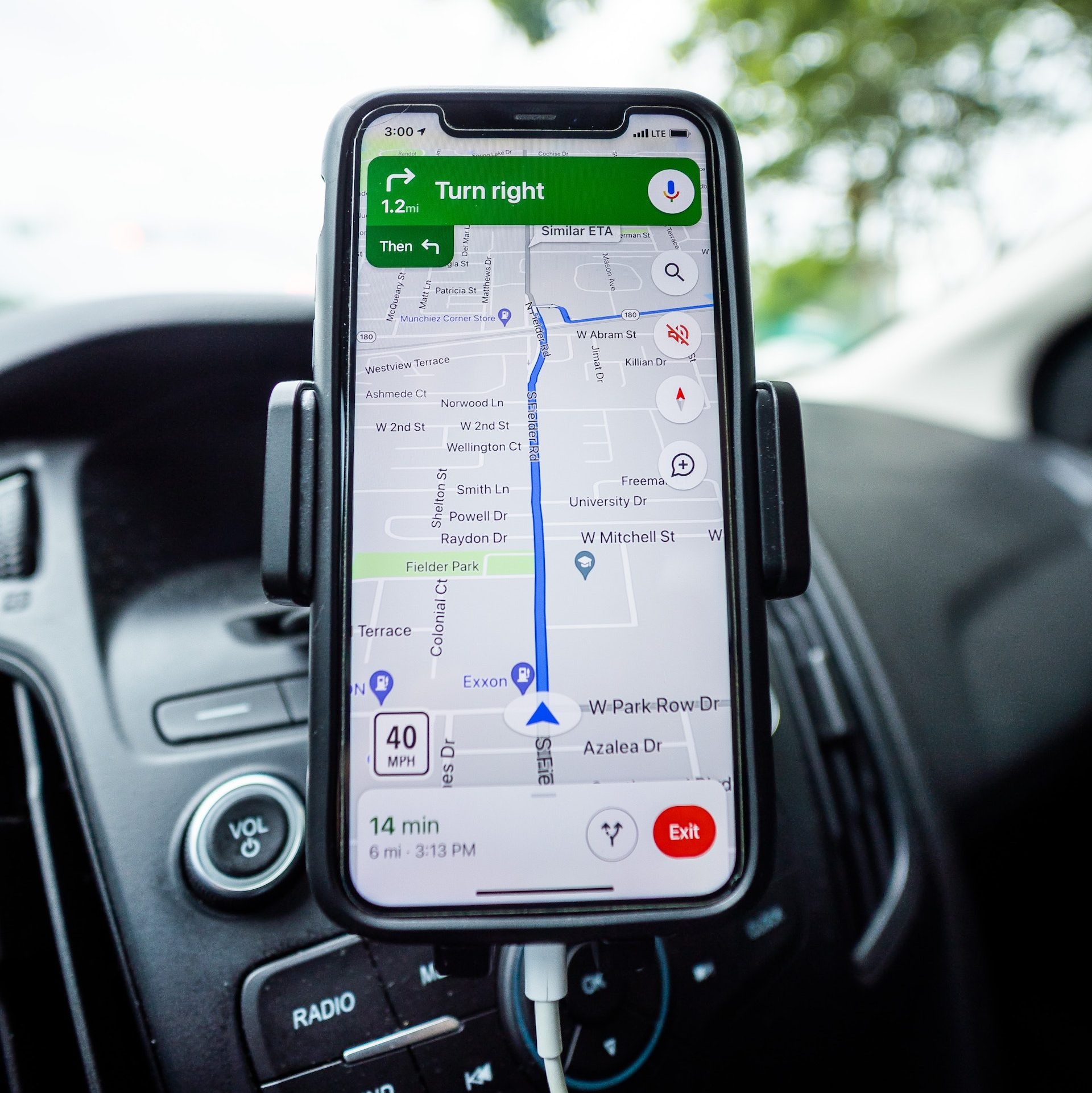
Waze monitors and keeps track of traffic data and reports from local and governmental transportation authorities, which Google leverages to formulate traffic patterns for specific roads and locations. This form of predictive analysis allows Google to provide traffic information to users at particular times of the day.
Not just that, but Google Maps uses this information to suggest a particular route over another, developing your trust in the app. If you’re uncomfortable with Google monitoring your day-to-day movement, then simply turning off the location services on your phone should do the trick. But beware that we wouldn’t have access to traffic data that can be relied upon if everyone started doing that.
How Google Intends To Resolve Privacy Concerns – Differential Privacy ⁉️🙋
Privacy is a big issue with any geographic technology. And Google maps amplifies these concerns because of how detailed the level of information can be from a specific street address down to individual people when the Google ecosystem connects to things like your Gmail account, your digital wallet, or even your wifi network.
As of August 2022, Google has mapped more than 250 countries and territories, but as it’s added more data and ingrained itself more and more into our lives and culture, users and regulators have pushed back and demanded guardrails and thresholds.
Google has also faced criticism, and in some cases taken to court, for the amount of data it collects – street view images showing private property and grabbing data from unsecured wifi networks with street view cars.
In response to backlashes, Google says the data from you that it uses to inform traffic and busyness is anonymised. Google uses a technology treatment called differential privacy. This tech allows Google to separate you and your activity from what they aggregate from millions of people as signals to derive insights around business and specific navigational information such as how long the walk or the drive may take.
However, some data isn’t used to tailor your map, like noting that you’ve been to a location before. Google is also adamant that information is not sold or shared with third parties. Google also vouches for giving users privacy controls like toggling location history on or off, searching in incognito mode and auto-deleting location data.
However, with the entire application, they’re continually improving how they manage the information, some of which may be sensitive. Google believes they capture to protect people’s privacy and ensure they only have the critical data to help power the most valuable products.
Google Maps – The Good, The Bad, & The Next Steps 😎
With its technological advances, advertising priorities, and criticism, Google Maps has helped change how we navigate the world and make travel and navigation much less daunting than they used to be.
The most significant improvement that Google Maps has made is making geographic information much more accessible to almost everyone.
The biggest downside, however, is that there’s something about paying much closer attention to the intricacies of every movement you make while carrying your phone.
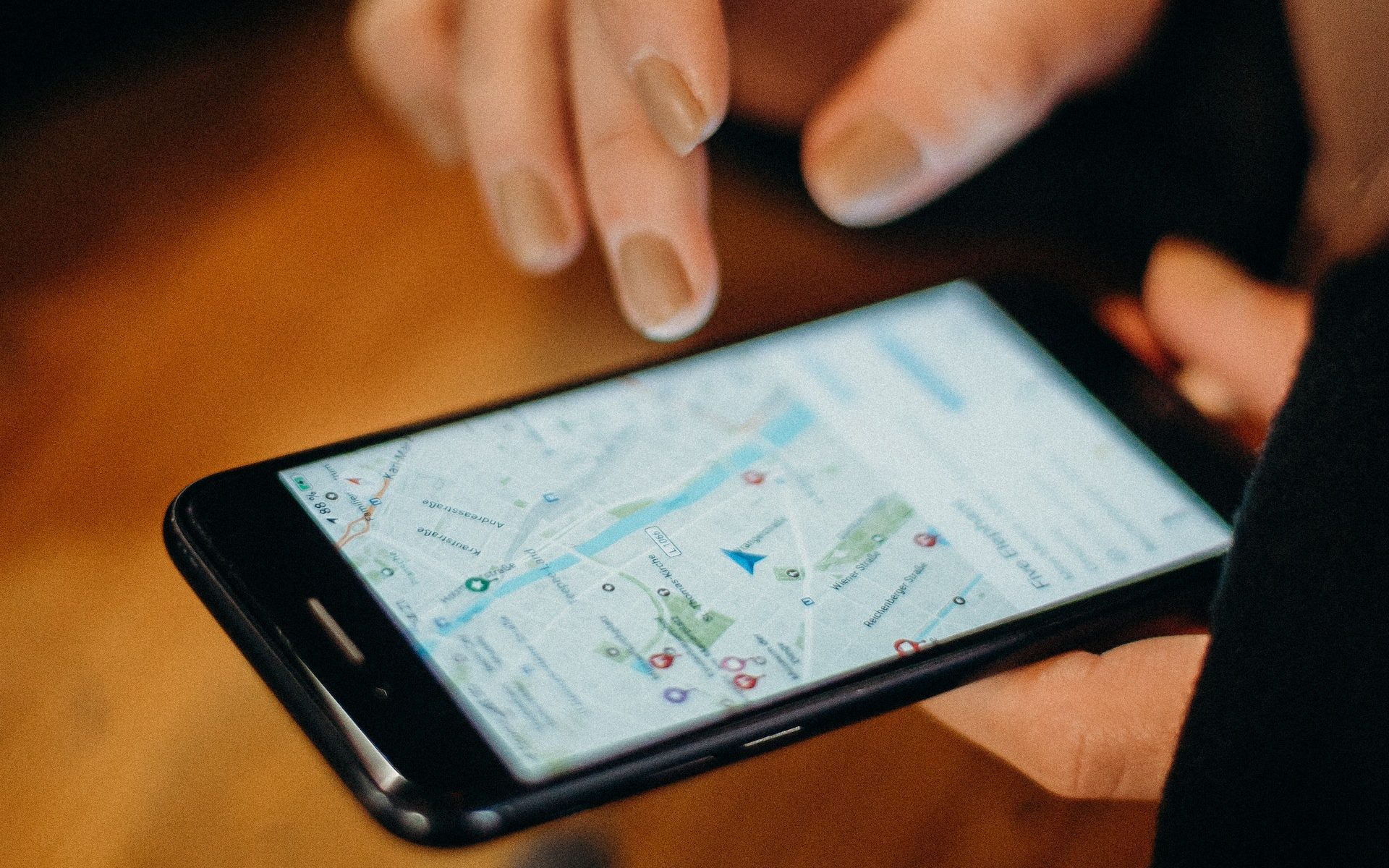
Addressing privacy concerns is a challenge that Google Maps will always strive towards, but what else can be done to make the platform more intuitive and valuable?
Google says the future of Maps aims to be more comprehensive and immersive. They’re potentially working towards taking technology to combine and fuse satellite imagery, aerial imagery, street view imagery, and user contribution to create a photorealistic view of what it might feel like to check out a park.
This would mean fully integrating augmented reality into the application’s user experience. The immersive view is Google’s next step in using its database of information and imagery to map the world.
We hope you enjoyed this journey as we sailed through the origin, transformation, and tech behind Google Maps. This app that embodies convenience in travelling is just one of many incredible modern-day case studies of how technology has improved our quality of life and made a potentially challenging task like travelling and navigating much more effortless.
If you want to learn more about how technology can help your business make your customers’ lives easier, reach out to us. We’d be happy to discuss the unique possibilities that technology has to offer.
Topics
Published On
November 03, 2022

